Cells
The Cells feature provides you with comprehensive, up-to-date information about cell towers worldwide.
Working with the Map
Cell towers on the map are represented by colored pins labeled with the respective mobile network technology (2G, 3G, 4G, 5G, CDMA) or labeled "Unknown" for unidentified cell towers.
For improved visualization and navigation, towers close to each other are clustered together. To view the content of a cluster, simply zoom in on the map. Zooming breaks down clusters into individual tower pins.

Above: Cell towers clusters
In general, clustering works as follows: zooming in breaks down clusters, while zooming out creates them.
Tapping on a pin displays details about the selected cell tower.
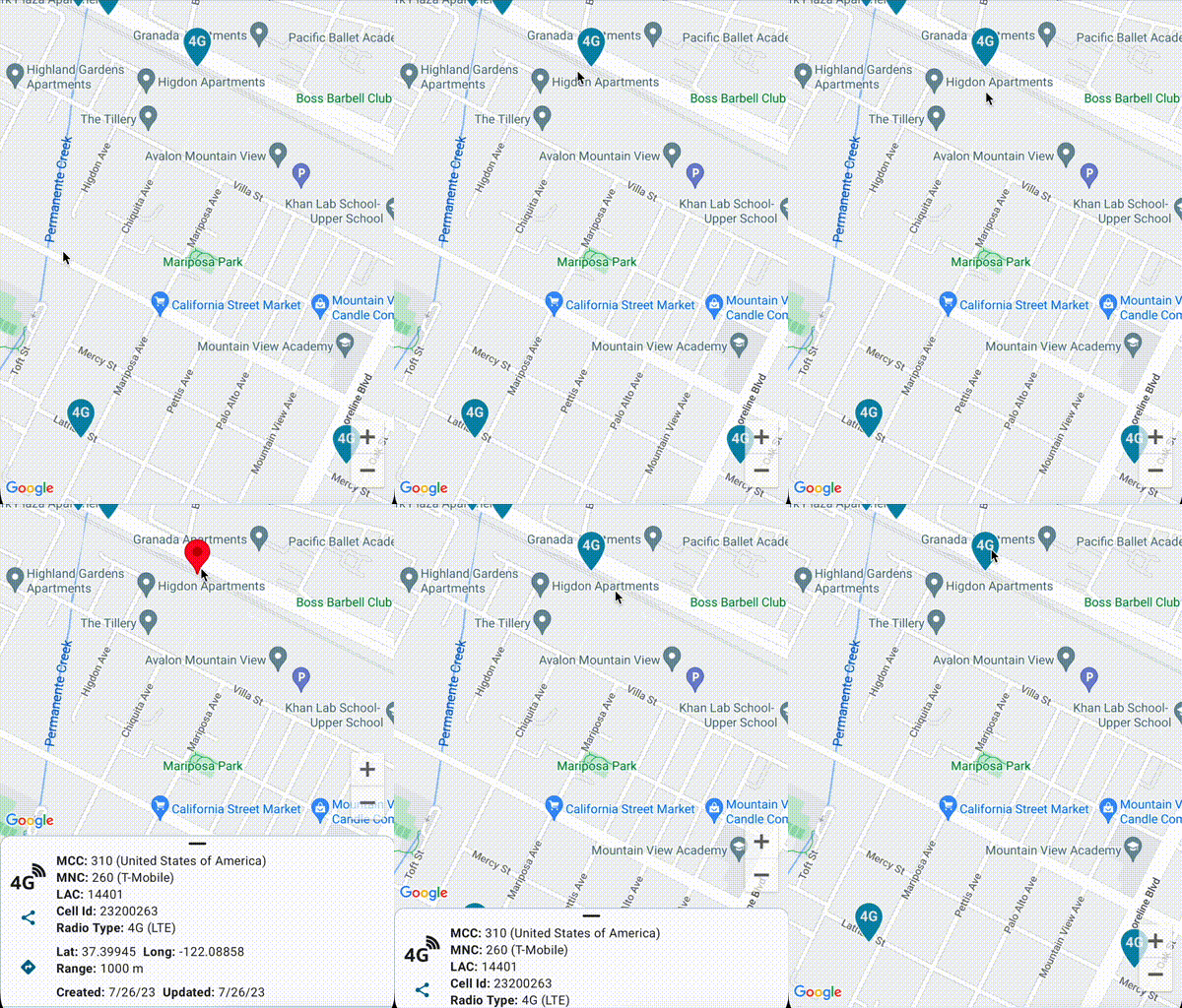
Above: Cell tower information
Selected cell tower details can be shared using the 'Share' button on the left. Additionally, you can navigate to the selected cell tower by tapping on the 'Navigate' button below the 'Share' button.
While browsing the map, you may notice cell towers connected by lines.
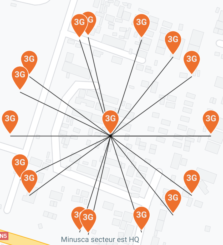
Above: Linked cell towers
These lines indicate that, for improved visual representation and usability, the precise location of the cell tower has been slightly adjusted, with the line leading to the actual cell tower location.
Viewing Cell Towers Around You
To view cell towers around your current location, the app requires location permission. If it's not granted when launching the "Cells" screen, you will be prompted to do so. Once location permission is obtained, GSM Signal Monitor will automatically locate you and zoom the map to your location at a predefined zoom level. If you move the map away from your current location, you can easily navigate back to it by clicking the location button, located at the top right corner of the map.
Navigating to a Cell Tower
With four known primary parameters, the app can locate a specific cell tower around the world. The required parameters for locating a cell tower are:
- MCC (Mobile Country Code)
- MNC (Mobile Network Code)
- LAC (Local Area Code)
- CID (Cell Tower ID)
To navigate to a cell tower, click on the cell tower icon in the top right corner of the screen.

The "Go To Cell" dialog will open, where you can enter the four primary parameters of a cell tower.

Once entered, click on the search button. If a cell tower is found in our database, the map will zoom to its location.
Data Sources and Updates
Cell tower data is sourced from reputable providers such as OpenCell ID, Mozilla Location Services, and third-party sources, processed, and stored on VMSoft servers. The data is updated daily to provide users with the most accurate and up-to-date information. Higher zoom level clusters are regenerated on a monthly basis.
Service Availability
Data is hosted on VMSoft Lab. LTD server infrastructure, which aims to provide fast and reliable access to the cell tower dataset. However, due to unforeseen circumstances such as power outages, internet connectivity issues, or heavy server loads, data may become unavailable for short periods.
Feature Roadmap
Initial release (backend development and initial feature implementation in GSM Signal Monitor app)- Places search
- Filtering cell towers by mobile network technology
- Offline support
- Archived cell towers
- Making the cell towers API publicly available
- Cell tower tracking
Licensing Notes
Data sourced from Mozilla Location Services is public domain.
Data from the OpenCelliD Project is licensed under a Creative Commons Attribution-ShareAlike 4.0 International License
Data obtained from third party sources is subject to individual licensing contracts between VMSoft Lab. LTD and data providers.